Pine Mountain Settlement School
Series 09: BIOGRAPHY – Staff
Series 12: LAND USE
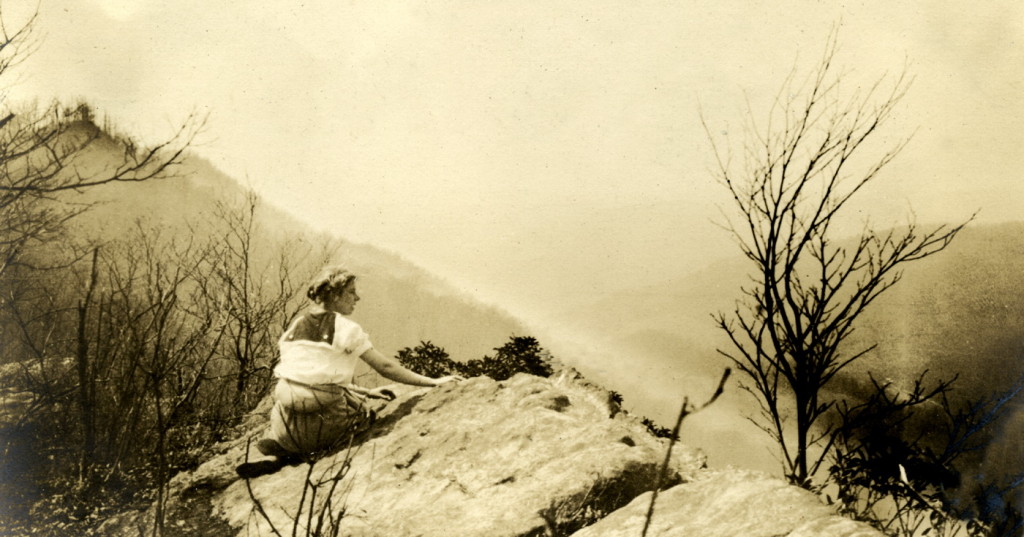
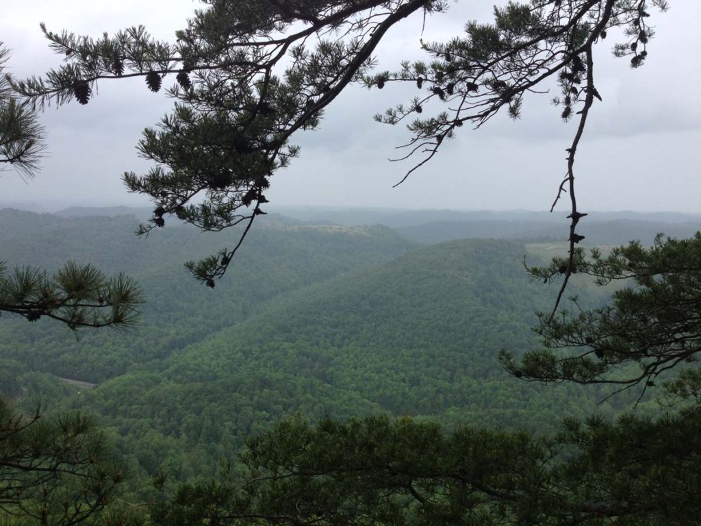
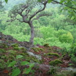
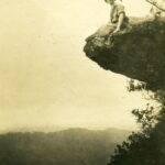
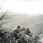
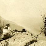
Celia Cathcart seated on rock at Jack’s Gap, above PMSS. [hook_album_2blk__034.jpg]
TAGS: Little Shepherd Trail, Little Shepherd Trail Association, Kentenia State Forest, Department of Natural Resources, Little Shepherd of Kingdom Come, forestry, forest rangers, Putney KY, Cam Smith, William (Bill) Hayes, Elmore Grim, Astor Holcomb, Wilson Wyatt, Burton Rogers, ARC, Pine Mountain, Raven’s Rock, Jack’s Gap, Marguerite Butler, Katherine Pettit, Dr. Kenneth Thompson, Gene Butcher, H.W. Berkman, Civilian Conservation Corps, Joe Creason
LITTLE SHEPHERD TRAIL
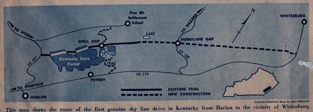
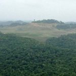
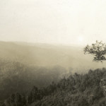
The Little Shepherd Trail is a small road that provides access to Kentenia State Forest, the oldest state-owned forest, acquired by the Kentucky Division of Forestry in 1919 as a gift from the Kentenia-Cantron Corporation. The Little Shepherd Trail serves as a fire break for the Kentenia State Forest located on the south side of Pine Mountain in seven scattered tracts totaling 4,277 acres. The largest of these tracts is accessible by the Little Shepherd Trail on the crest of Pine Mountain …
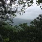
JACK’S GAP: Inspiration for the Trail
On August 14, 1914, Marguerite Butler, a worker at Pine Mountain Settlement School, wrote home to her mother about her adventures in establishing the new settlement school on the North Side of the long stretch of mountain called “Pine Mountain.” One of the favorite activities of the early staff at the School was to hike to the high ridge top to take in the view of the sea of mountains stretching across the counties of eastern Kentucky. Marguerite writes:
About three o’clock Mr. Frost (the son of [the] Berea president who is going to Yale this year), Miss Watts and I took a six or seven mile [hike] _______ up to Jack’s Gap where we had one of the loveliest views I have ever had. There were simply miles and miles of wooded mountains, one seeming to rise higher than the rest. It was a hard climb up the trail but we rested about six times on the way. We watched the sunset from there and then made our way back to the road reaching it just as the moon came up over the mountains. The first house we passed the folks called us in and cut two big watermelons. I don’t think anything tasted better. It was a typical mountaineer’s house. We sat on the little front porch and watched the moon rise and just enjoyed that melon. A mile’s tramp along the road brought us home where they had saved the best supper for us – sweet potatoes, cottage cheese, hot biscuit, slice[d] tomato and cucumber, apple sauce and cider which was just made today.
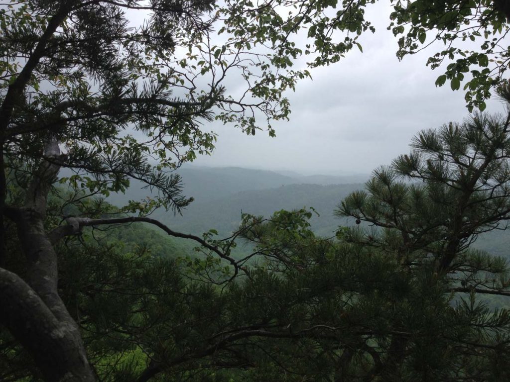
The view from Jack’s Gap above the settlement school is but one of many scenic vistas along the crest of the Pine Mountain. The rolling and steep escarpment of the north side is a struggle to ascend but seldom does the view disappoint. With the arrival of the automobile and more mobility in the population, the desire to share the spectacular views from the top of this unique mountain sparked a chain of events that led to the creation of what is today called the Little Shepherd Trail.
LITTLE SHEPHERD TRAIL: William Hayes
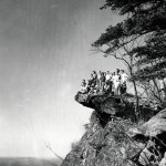
Little Shepherd Trail, Pine. Photo: H. Wykle. [2012-05-13 02.49.15.jpg]
On December 23, 1958, William Hayes wrote a letter to Cam Smith, the County Judge for Harlan County, regarding road funding that was proposed for Harlan County. It was the beginning of a dialog that would result in the eventual construction and re-construction of a small road along the crest of Pine Mountain. This road was to later be named the Little Shepherd Trail, after John Fox Jr.’s popular novel, The Little Shepherd of Kingdom Come, that was set in the area.
In his plea for assistance in developing what was then a trail, Bill sent to Cam Smith a two-page justification for the use of county money to fund development of the road. He wrote
…I wish only to speak from my own personal observations of the rural roads which I feel could help the work situation as well as open up recreation areas and provide easy access to some of our timber boundaries…
Bill believed the road, would facilitate monitoring and fighting seasonal forest fires, but would also serve the public with “…turnouts for picnic spots and the like ….” And, stretching his vision even further, he noted that
With very little work a rough trail could be graded out from 421 highway to Camp Blanton and on to Gross Knob Lookout Tower, along the top of Pine Mountain and off by way of the Gross Knob Truck Trail. This would make a nice Sunday afternoon drive for our people as well as tourists. [SEE IMAGES OF FULL LETTER BELOW]
LITTLE SHEPHERD TRAIL: Groundbreaking
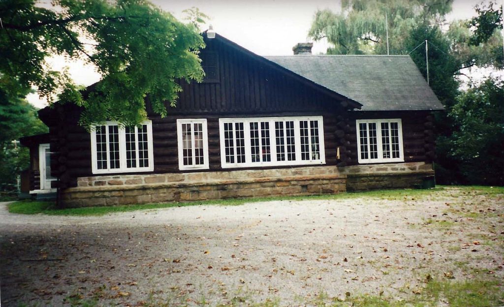
Putney Forestry Station. View of west flank. Photo: P.D. Christian. [hayes_putney_pd_01.jpg]
Plans were then made for a “breaking-ground” ceremony that would include Pine Mountain and a breakfast for all advocates at the Putney Ranger station in June 1961. Among the dignitaries invited to the groundbreaking ceremony were Kentucky Governor Bert T. Combs and staff. The Governor was unable to attend, but he appropriately sent Wilson Wyatt, Lt. Governor, who early in his career had served as General Counsel for the Louisville Courier-Journal and the Bingham family, owners of the newspaper. Barry Bingham, owner of the newspaper was for years a member of the Pine Mountain Settlement School Board of Trustees. Wyatt broke the ground for the new road. Other dignitaries in attendance included Dr. Kenneth Thompson, Berea Dean, Gene Butcher, Ben Lewellen, Mark Sisk, Lyle Shoemaker, Sam Wheeler, John Lyons, H.V. Hilton, C.D. McDowell, Astor Halcomb and the forestry supervisors, H.W. Berkman, and Gene Butcher.
All guests were treated to a hearty Kentucky breakfast at the Putney Ranger Station, also home of Bill and Fern Hayes. The guests were served Kentucky ham and red-eye gravy, biscuits, scrambled eggs, and completed their breakfast with a white cake with candied violets baked by Ranger Bill Hayes’ wife, Fern Hall Hayes. Assisting with the breakfast were Bill Hayes’ mother, Daisy Hayes from Coxton, and his mother-in-law, Myrtle Hall from Viper in Perry County.
Joe Creason, a journalist from the Louisville Courier-Journal, was on hand to record the groundbreaking event in a full-color spread that appeared in the June 25, 1963, issue of the Louisville Courier-Journal Magazine. Creason’s description of the visit of Lieutenant Governor Wilson Wyatt to Pine Mountain and the ceremonial “breaking-ground” event captures the excitement of the entourage and the high hopes that all had for the trail.
When Wyatt turned the first shovel of dirt for the road that Bill had proposed in 1958, he was an enthusiastic supporter but with empty pockets. It was a road that would first be paid for, not by the Department of Transportation, but by the Kentucky Division of Forestry. Funding would still be insufficient many years later but the departmental start-up still held promise for more robust funding and refinement of the proposed 38-mile-long rustic sky-line drive.
LITTLE SHEPHERD TRAIL: The Work Begins
Joe Creason, the author of the June 25, 1961, Courier-Journal article, “Top O’ the Mountain,” noted that when Wyatt broke ground for the new “skyline drive” he spoke with some urgency that work get started right away. Under Bill’s direction, work on the road extension and improvement started immediately. The early Civilian Conservation Corps road and fire breaks and logging trails, already on some six miles of the mountain’s crest, were widened to twelve feet. Ditches were dug and culverts were inserted along a six miles stretch. The cost of the remarkable local effort, paid through the Putney Forestry Station headed by Bill Hayes, and allocated by the Kentucky Division of Forestry, was just over $400, “a ridiculously low cost.” noted Creason.
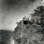
Little Shepherd Trail view. Photo: H. Wykle. [IMG_0197x.jpg]
Work continued on what Joe Creason called a “shoestring” and soon some 17 miles were completed, six of which had neither fire-break nor logging trail to ease the construction. Wilson Wyatt, ever the penniless but big idea man, believed that if the road could be built even in its crudest form, it would attract users and its growth would continue from this effort. It was a classic, “Build it and they will come,” scenario. Creason quotes Wyatt:
…let’s create a road usable enough to attract automobile drivers and hikers and give them a taste of what a sky line drive could be….This can’t be a costly, production-type road; it can be only a rustic beginning of what someday will be a genuine sky line drive. For if enough people see the views along this trail, there will be clamor to get it improved until it becomes a real road …In other words, use would create a demand for the next logical steps in development — from dirt to gravel to pavement.
Creason continues with his own review of the effort:
The result is not a speedway. Instead, it is a rustic, slow-cadence, traffic-worthy trail that opens up perhaps the widest sweep of unspoiled mountain vistas in Kentucky.
LITTLE SHEPHERD TRAIL: Federal Funding
This low-cost “rustic, slow-cadence, traffic-worthy trail” soon became an issue as the State later tried to secure Federal highway funds. The argument goes that the “rustic” nature of the road signaled to the federal folk that the road was below “standard” and therefore did not qualify for federal funding. This argument would appear again and again during the course of construction and in later years as the Little Shepherd Trail Association worked to clear rights of way and extensions of the Trail.
Today the “sky-line” drive does stretch the full 38 miles, but it does not open up “the widest sweep of unspoiled mountain vistas” — surface mining spoiled that dream. During Wyatt’s tenure in office the estimated $113,480 was never allocated to complete the road. “Completion” of the full 38 miles would have included the new construction which would have required, as well, gravel, new culverts, and tree and brush clearing , labor and machinery. Wyatt had cut the ribbon, but his road and his financial support were never delivered. Bill Hayes and his crew continued with their dream, “extemporaneously” (as Joe Creason put it) progressing as they could find time and money over the years. The State Department of Parks and Highways eventually contributed a smattering of funding, but never fully engaged the project.
Early map with proposed route. [Louisville Courier Journal} June 25, 1961. Joe Creason article. ]
1970 LITTLE SHEPHERD TRAIL ASSOCIATION EFFORTS
An attempt was made in 1970 to follow through with concessions made by the U.S. Bureau of Public Roads that would allow
…the design of the scenic road along the crest of Pine Mountain to be below normal standards for roads constructed with federal funds. It had been pointed out at earlier meetings that such design is not necessary or desirable on the Little Shepherd Trail because it is not intended for high-speed driving and its primary purpose is to be a scenic route, which eventually would extend from Pine Mountain State Park at Pineville to the Breaks Interstate Park on the Kentucky-Virginia border. The graveled road is now complete from its intersection with US 421 near Harlan to Whitesburg, a distance of 38 miles.
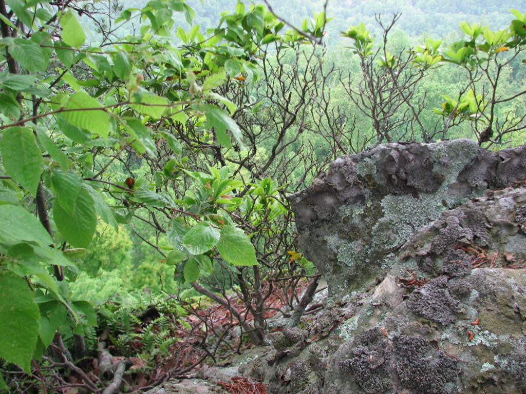
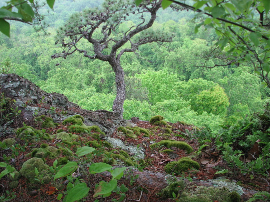
Lichen along the Little Shepherd Trail. Photo: H. Wykle. [2012-05-13 02.48.23.jpg]
Today, with some funding from the state Department of Highways and maintenance from the County of Harlan, the road, essentially one lane and paved only in sections, stretches from highway #421 to Laden Trail where it dog-legs into a section that stretches from Laden to Kingdom Come State Park and then on almost to Whitesburg.
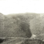
Little Shepherd Trail, 2012. Photo: H. Wykle. [IMG_0205x.jpg]
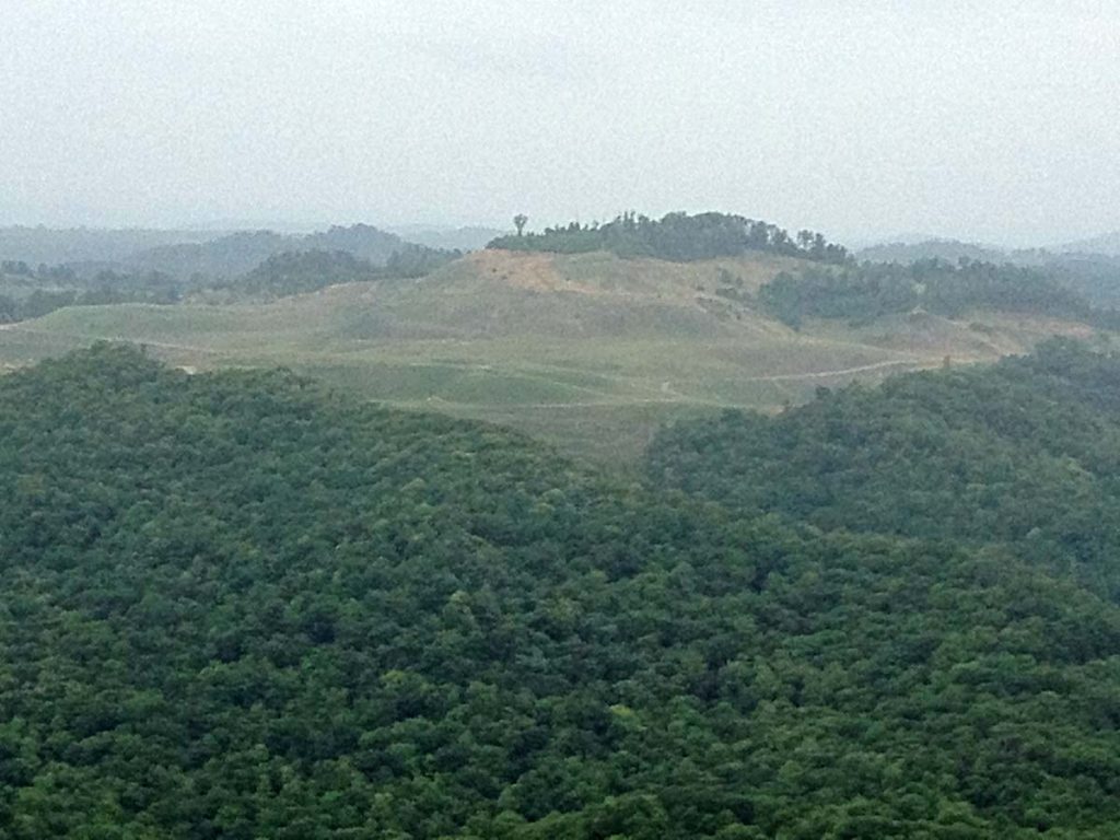
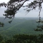
The destruction of the mountains began in the 1960s and slowly the long, fog-shrouded views from the crests of eastern Kentucky’s mountains began to reveal long scars of disturbed earth. Many mountains lost their tops and small hollows disappeared under tons of “over-burden.” The long views that so enchanted mountain climbers from the days of John Fox Jr. and into the 1960s began to show man’s careless hands and heads near the end of the 1960s. The disturbed view-shed that was at first an aggravation later turned into a heartbreak for both Bill and for the environmentalists of the region as well as those view-seekers along the trail. The destruction of viewsheds still continues but, thankfully, the “sky-line” drive as a tool for redemption in the region has not been fully utilized. The road today requires an “amble.” Not, a race across the “sky-line”. The trail allows the traveler to get out of the car and look out over the land to both the North and the South. It allows the traveler a panorama of Eastern Kentucky enjoyed at a liesurly pace. It showcases one of Kentucky’s most beautiful regions and also some of its most disturbed landscapes. If more drivers were to amble the 38 mile course, their view could be an eye-opener as well as a mind-opener. The view from above is the best means of assessing the damage of surface mining as it turns the areas green rolling mountains to intermittent scars and filled hollows.
Little Shepherd Trail, 2012. Photo: H. Wykle. [IMG_0252x.jpg]
Most of the original “Honorary Shepherds” are no longer with us, but the dreams live on in other shepherds of our environment. Today the forest is growing over the scars of mining and new vistas are opening up and the shepherds of Harlan and Letcher counties lift up their eyes to the long mountain that stretches through their land and they continue to admire and dream.
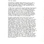
CREATION OF THE LITTLE SHEPHERD TRAIL
Putney
December 23, 1958
Mr. Cam Smith, County Judge
Harlan, Kentucky
WH/fh
Dear Mr. Smith:
According to a recent news article, we are to get a special road building program in Harlan County. I know that you will play a big part in helping the Highway Department decide on what projects will be most helpful to the County.
I wish only to speak from my own personal observations of the rural roads which I feel could help the work situation as well as open up recreation areas and provide easy access to some of our timber boundaries. As we well know in the county, the mountains are quite high and are not always the easiest thing to get on top of. Since we are burdened with a yearly forest fire problem every spring and fall, old roads cleaned out or new ones built would certainly cut down on fire damage to our timberlands.
We have a fairly good truck trail leading from 421 highway along the tip of Pine Mountain, east to Banks Branch just below Dione, a distance of 17 miles. This trail could be one of beauty and very useful as a fire break. A crew of 50 men could spend several weeks or months on this trail cutting out ditch lines and putting in culverts. Some of the heavy grading equipment later running over the road could put a few more turnouts for picnic spots and the like. Later a good coat of gravel could be put on the entire length of the trail. This trail covers the entire length of the Kentenia Forest, which I think the people of the County should get more enjoyment from. With very little work a rough trail could be graded out from 421 highway to Camp Blanton and on to Gross Knob Lookout Tower, along the top of Pine Mountain and off by way of the Gross Knob Truck Trail. This would make a nice Sunday afternoon drive for our people as well as tourists. This trail should be completed in the east along the top of the mountain to the Sand Hill Road (Ky. 160) at Cumberland. This would give us roughly 30 miles of mountain top road. I do not know how many men this would take but it certainly should help the labor situation.
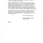
p.2
Another trail leading from the top of the Big Black Mountain at Lynch to Lewallen called the Fuiggitt’s Creek Truck Trail could be graded and graveled, a distance of 22 miles. This would create a scenic trail on the highest mountain in Kentucky and make a short route for some of our Cloverfork miners who may be working at Benham and Lynch.
That old truck trail on Path Fork from Indian Grave Gap to Rockhouse Gap ad on to the Chunklick Lookout Tower would certainly open up a wonderful recreation area and make logging operations feasible in the Little Black Mountain area. This road needs trimming out, ditching and grading and a good coat of gravel. This road is north of the Cumberland Gap National Park lying parallel with beautiful upper Martin’s Fork River.
I feel that if any of these roads could be opened up, it will not only create new jobs but give us better protection for the one natural resource that will reproduce a marketable crop in our generation. That is our forest.
Very sincerely yours,
William Hayes, Ranger
Kentenia Unit
GALLERY: Little Shepherd Trail Correspondence
-
- Little Shepherd Trail Correspondence, 1958, page 1. [hayes_cam_smith_letter_01.jpg]
-
- Little Shepherd Trail Correspondence, 1958, page 2. [hayes_cam_smith_letter_02.jpg]
GALLERY – Little Shepherd Trail
-
- Little Shepherd Trail, 2012. Photo: H. Wykle. [2012-05-13 02.49.15.jpg]
-
- Little Shepherd Trail, 2012. Photo: H. Wykle. [IMG_0197x.jpg]
-
- Little Shepherd Trail, 2012. Photo: H. Wykle. [2012-05-13-02.48.23.jpg]
-
- Little Shepherd Trail, 2012. Photo: H. Wykle. [IMG_0205x.jpg]
-
- Little Shepherd Trail, 2012. Photo: H. Wykle. [IMG_0252x.jpg]
-
- Katherine True Album: “E.K.R. [Enid K. Rutledge] Jack’s Gap.” [pmss_tru076.jpg]
-
- Roettinger Album. “Ethel [McCullough] on Jack’s Gap” on Pine Mountain above the School. [Woman holding a walking stick with two hands.] [roe_054a.jpg]
-
- View from Jack’s Gap. [nace_1_050d.jpg]
-
- Jack’s Gap, 1947. [nace_1_072a.jpg]
-
- Jack’s Gap outing. Arthur W. Dodd Album. [dodd_A_066_mod.jpg]
-
- Jack’s Gap outing. Arthur W. Dodd Album. [dodd_A_065_mod.jpg]
-
- Frank Cornett’s place from Jack’s Gap. [nace_1_072b.jpg]
-
- Celia Cathcart seated on rock at Jack’s Gap, above PMSS. [hook_album_2blk__034.jpg]
-
- “On a hike” at Jack’s Gap, unknown woman. [X_099_workers_2527p_mod.jpg]
-
- Jack’s Gap. Katherine Pettit (older woman with hat to left of image) and Ethel de Long (back against pine tree) and children at Jack’s Gap, above PMSS. [X_099_workers_2524a_mod.jpg]
|
Title |
Little Shepherd Trail |
|
Identifier |
|
|
Creator |
Pine Mountain Settlement School, Pine Mountain, KY |
|
Alt. Creator |
Ann Angel Eberhardt, Helen Hayes Wykle ; |
|
Subject Keyword |
Little Shepherd Trail, Pine Mountain Settlement School, Little Shepherd Trail Association, Kentenia State Forest, Department of Natural Resources, John Fox Jr., Little Shepherd of Kingdom Come, Harlan County, Letcher County, scenic drives, forestry, forest rangers, Putney, KY, Cam Smith, William (Bill) Hayes, Elmore Grim, Astor Holcomb, Wilson Wyatt, Burton Rogers, ARC, forests, Pine Mountain, 421 Highway, Raven’s Rock, Jack’s Gap, Marguerite Butler, Katherine Pettit ; |
|
Subject LCSH |
Little Shepherd Trail. |
|
Date |
2016-06-06 |
|
Publisher |
Pine Mountain Settlement School, Pine Mountain, KY |
|
Contributor |
n/a |
|
Type |
Collections, text, image ; |
|
Format |
Original and copies of documents and correspondence in file folders in filing cabinet |
|
Source |
Series 09: Staff/Personnel, Series 12: Land Use ; |
|
Language |
English |
|
Relation |
Is related to: Pine Mountain Settlement School Collections, Series 09: Staff/Personnel and Series 12: Land Use. |
|
Coverage Temporal |
1914 – 2012 |
|
Coverage Spatial |
Pine Mountain, KY, Harlan County, KY, Letcher County, KY, Putney, KY ; |
|
Rights |
Any display, publication, or public use must credit the Pine Mountain Settlement School. Copyright retained by the creators of certain items in the collection, or their descendants, as stipulated by United States copyright law. |
|
Donor |
n/a |
|
Description |
Core documents, correspondence, writings, and administrative papers of about Little Shepherd Trail, clippings, photographs, books about Little Shepherd Trail ; |
|
Acquisition |
n/d |
|
Citation |
“[Identification of Item],” [Collection Name] [Series Number, if applicable]. Pine Mountain Settlement School Institutional Papers. Pine Mountain Settlement School, Pine Mountain, KY. |
|
Processed By |
Helen Hayes Wykle, Ann Angel Eberhardt ; |
|
Last Updated |
2016-08-14 hhw, 2019-03-27 hhw |
BIBLIOGRAPHY – Little Shepherd Trail
Creason, Joe. "Top O' The Mountain: Work on first sky line motor trail in Kentucky gets off to a fast start." The Louisville Courier Journal Magazine, June 25, 1961, pp.8-10, 12-13.

"New Camp Sites Are Planned For Little Shepherd Trail." Tri-City News, February 12, 1970.

Fox, John jr. The LIttle Shepherd of KIngdom Come. [Attained international fame and was the first book to sell 1 million copies in the United States.]

"Little Shepherd Trail Has Vast Recreation Potential." The Harlan Daily Enterprise, September 15, 1965.

"Your Passport to Wild Beauty," Our Heritage, June 1967. [contains map]

The Appalachian Regional Commission has under consideration a proposal to extend the trail from Harlan to Pineville. The plan also includes [the] extension of the trail from Whitesburg to the Breaks Interstate Park, making it 103 miles long. [Comments by Thomas Prather, president of the Little Shepherd Trail Association, Inc. ]

"Federal, State Funds For Building Trail Are Assured. If Property Owners Willing To Donate Needed Right of Way." The Harlan Daily Enterprise, May 1, 1968.

Tom Prather reported on the announcement by Governor Louie B. Nunn on proposed funding by the Appalachian Regional Commission. Funding is pending approval by the U.S. Bureau of Public Roads of road standards.

"Little Shepherd Trail Group Urged 'Start Today.'" The Harlan Daily Enterprise, May 2, 1968.

Meeting of the Little Shepherd Trail Association with key speaker Frank Groschelle, Kentucky Area Development Office speaking to recent efforts to secure federal funds for extension of the Trail. Members adopted a resolution that urged Governor Louie B. Nunn to locate a forestry camp on Pine Mountain along the LST. Creation of "Honorary Shepherds."

"Right of Way Not Obtained. Pine Mountain Trail Funds In Danger of Being Lost." The Harlan Daily Enterprise, October 29, 1970.

Unless right of way can be obtained for the Trail, 1 Million dollars from the Appalachian Regional Commission may be lost. Calvin Grayson, member of the Little Shepherd Trail Association warned that concession made by the U.S. Bureau of Public Roads could be lost.

"UK Fraternity Helps Clean Mountain." Tri-City News, April 8, 1971.

Members of the Phi Delta Theta fraternity helped the state Division of Forestry clean up picnic areas along a section of LST. "...students found that someone had stolen all the signs naming the picnic spots and overlooks. They also noted that all the trash receptacles were the victims of numerous bullet holes...." The first 17 miles of the trail was constructed in the 1930's by the Civilian Conservation Corporation [sic]. The Kentucky Division of Forestry completed it by building 21 miles in 1961 and 1962.

"Association Regrouping to Promote Tourism Along Little Shepherd Trail," by Lisa Fee. Harlan Daily Enterprise November 26, 1988.

Work at revitalizing the Putney Forestry Station is described, as is the work of the Little Shepherd Trail Association, headed by Dr. John Bianchi, to revitalize the Association and pull in new ideas. Blueprints are revised for planned recreation use of the Forestry Station.

Division of Forestry Kentenia State Forest. http://forestry.ky.gov/Kentuckysstateforests/Pages/KenteniaStateForest.aspx
Accessed 2016-08-13.

Kentenia is the oldest state-owned forest, acquired by the Kentucky Division of Forestry in 1919 as a gift from the Kentenia-Cantron Corporation. It is located along the south side of Pine Mountain in seven scattered tracts totaling 4,277 acres. The largest of these tracts is accessible by Little Shepherd Trail on the crest of Pine Mountain ...

Little Shepherd Trail and Kentenia State Forest. [Official website]
http://www.harlancountytrails.com/littleshepherdtrail.php
Accessed 2016-08-12.

"Little Shepherd Trail on Pine Mountain, Kentucky." http://www.donchesnut.com/motorcycle/londonwhitesburgloop/littleshepherdtrail.html
Accessed 2016-08-12.

IMAGES for Little Shepherd Trail. https://www.google.com/search?q=little+shepherd+trail&newwindow=1&safe=active&tbm=isch&tbo=u&source=univ&sa=X&ved=0ahUKEwjQ957s17zOAhXB6SYKHZnaBE0QsAQIJg&biw=1858&bih=995
Accessed 2016-08-12.

Kentucky Natural Lands Trust. PROTECTING, CONNECTING & RESTORING WILDLANDS.  http://knlt.org/ Accessed 2016-08-12.
SEE ALSO:
WILLIAM HAYES (Part I)
WILLIAM HAYES (Part II)
WILLIAM HAYES (Part III)