Pine Mountain Settlement School
Series 12: LAND USE
LAND USE GUIDE
1913 – present
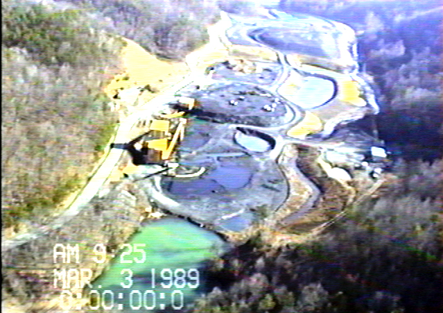
Dollar Branch, 1989. [DBranch3.jpg]
TAGS: Land use guide, land use documents, Dollar Branch, Lands Unsuitable for Mining, Little Shepherd Trail, Laden Trail, land use plans, Maps of PMSS area, timber and logging, Jack’s Gap, recreation areas, Look-out Tower, streams, William Creech land swap survey, hemlock survey
LAND USE Guide, 1913 – present
To be landless is not to lack property
But to lack responsibility.
— Scott Russell Sanders
Land use is how we negotiate our space. Space can be used as one of the analytical tools we study in order to think historically. Yet, as Doreen Massy* has reminded us,
We cannot understand place by enclosing it in boundaries … space is a simultaneity of stories so far ….
And space is created by the connections of people to the land and connections between peoples and bigger geographies.
The space in which Pine Mountain was created is more than geography and has been and is continually shaped, managed, and studied through actions that take place between those people. How those people occupy the space and their larger cultural geographies often determine what direction the land use will take. Over time, land use is fluid. It is dynamic, a historical record, and often it is contentious.
At Pine Mountain, this melding of the social, the physical and the mental — three types of space that Henri Lefebvre** in The Production of Space, 1974, sees as fundamental — can be seen in the archival record (documents and photographs) as well as in the current physical evidence of that space that is theirs. That space — that physical, mental, and social space —contains the stories of those who have lived there and it is building the stories of those who are still living there. In this area of the archive, space is also the land space that is documented in the official record, and there are many.
*See: Massy, Doreen. (1994) Space, place, and gender. Minneapolis: University of Minnesota Press.
**See: Lefebvre, (1958; 1992) Henri. The Social Production of Space. Wiley-Blackwell.
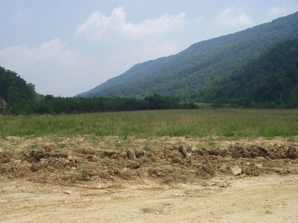
Dollar Branch following restoration. [OLYMPUS DIGITAL CAMERA, P8030003.jpg]
Land Use Guide: DOCUMENTS
Land use is one of the more fascinating and confounding aspects of the history of Pine Mountain Settlement School. In the archival record, land use is recorded by the following:
Series 12: LAND USE (Private)
LAND USE Introduction
LAND USE 1911 Wm. Creech Donor Land Swap Survey
BIBLIOGRAPHY Environmental Education and Land Use
LAND USE Recreation, Bickford Preserve, Hiking Trails
LAND USE Bickford Nature Preserve
LAND USE Jack’s Gap Recreation Area
LAND USE PMSS Coal Mine, Mining, and Miners
LAND USE PMSS Coal Mine Map
LAND USE Coal Mine at PMSS Draft Lease Agreement 1944
LAND USE Dollar Branch
LAND USE Dollar Branch Correspondence
LAND USE Jillson, Willard Rouse. “Agricultural Perspective of Kentucky Geology” 1925
LAND USE Lands Unsuitable for Mining Petition
Robin LAMBERT Biography – PASSWORD PROTECTED
LAND USE Gas
LAND USE Liens, Right-of-Way, Roads
LAND USE Little Shepherd Trail
LAND USE Road Report of Fox & Peck Engineers 1917
LAND USE Laden Trail or “The Road“
LAND USE Land Use Plan for PMSS, Mid-1930s (Christensen ?)
LAND USE Map Community Residents 1934 – 1942
LAND USE Maps Guide
LAND USE Maps of PMSS Area
LAND USE Pine Mountain Hemlock Survey 2000
LAND USE Plan for Pine Mountain Mid-1930s
LAND USE Planning and Site Indenture 1913
LAND USE Soil Survey of Bell & Harlan Co., KY
LAND USE Stream Study and Curriculum
LAND USE Timber and Logging Record
LAND USE Train Troubles
LAND USE Tree Removal Photographs
LAND USE 2004 Water Management Planning – Wellhead Protection Plan & PMSS Spring Protection Plan
LAND USE Water Protection Plan 1997-1998 Overview and Emergency Plan
LAND USE Report on Proposed Pine Mt School Site 1913
LEON DESCHAMPS The Perfect Acre
LOCAL HISTORY SCRAPBOOK Cumberland Gap 1815-1861 Part I
LOCAL HISTORY SCRAPBOOK Cumberland Gap & Vicinity Fall & Early Winter 1861 Part II
LOCAL HISTORY SCRAPBOOK Cumberland Gap 1861-1862 Part III
See Also:
DANCING IN THE CABBAGE PATCH Guide
DANCING IN THE CABBAGE PATCH III Place
FARM Drawings
FARM Library File
FARM Lime Kiln Processing
FARM Wells Record 08 Dairy Poultry Early History by Evelyn K. Wells
Farming the Land Early Years 1913-1930
GOVERNANCE Articles of Dedication PMSS and State Nature Preserve (Draft)
RESERVOIR
Biographies:
EVELYN K. WELLS Staff
KATHERINE PETTIT Director
MARY ROCKWELL HOOK Architect
ROBIN LAMBERT Director (Password Protected)
WILLIAM HAYES Staff Part III