Pine Mountain Settlement School
Series 12: LAND USE
Maps of Area
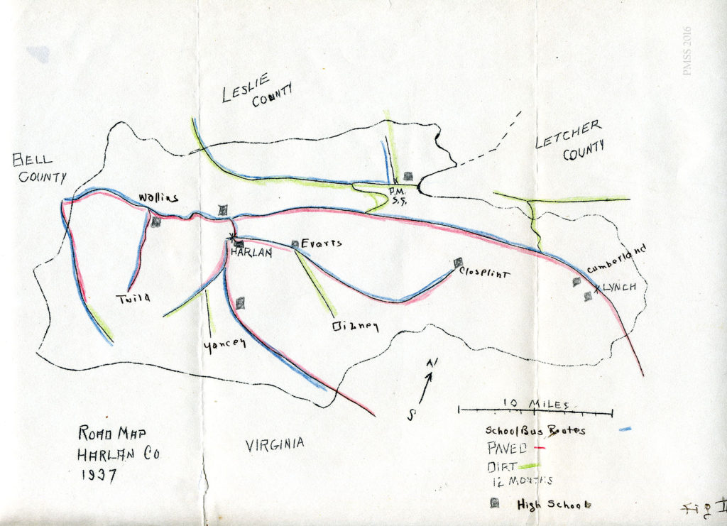
Map of roads in Harlan County, 1937. [roads_005,jpg]
TAGS: Land use, maps of PMSS area, maps, Pine Mountain Settlement School, campus maps, hiking trails, built environment, buildings map, road maps
LAND USE Maps of PMSS Area
GALLERY
-
- [_MSR5277_1.jpg]
-
- [_MSR5813_1.jpg]
-
- [_MSR5861_1.jpg]
-
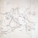
- [pmss_drawn_map001.jpg]
-
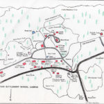
- [PMSSmap2004-copy.jpg]
-
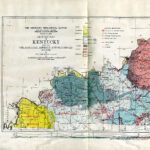
- Jillson, A.R. “Agricultural Perspective of Kentucky Geography.” map 1a. [agric_persp_ky_geo_398-ee1456865014723.jpg]
-
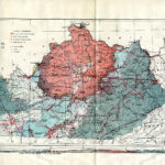
- Jillson, A.R. “Agricultural Perspective of Kentucky Geography.” map 1b. [agric_persp_ky_geo_398-ee1456865014723.jpg]
-
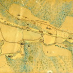
- Map of Pine Mountain Settlement School by Anon. c. 1930s?[map_hand_colored_001.jpg]
-
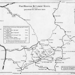
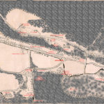
- [map_area_001.jpg]
-
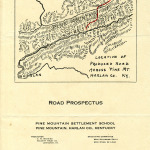
- Prospectus Map: Road on Laden Trail across Pine Mountain. [delong_road_pro_001.jpg]
-
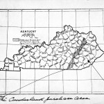
- “The Cumberland Purchase Area and The Big Trees” Map. [braun_lucy_trees004.jpg]
-
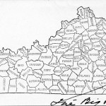
- “The Big Trees” Map. [braun_lucy_trees006.jpg]
-
- [map_ext_workmod.jpg]
-
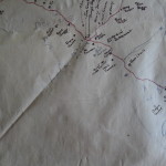
- Community Map of Pine Mountain valley – partial view of larger map showing Turkey Fork area, near Little Laurel. [P1050597.jpg]
-
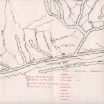
- Community Map of Pine Mountain Valley. Partial view of larger map with logging camp near Polly Turner’s and Rockhouse Creek, 1934-1942. [P1050596.jpg]
-
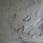
- Community Map of Pine Mountain valley – partial view of larger map showing families surrounding the Big Laurel Medical Settlement on Greasy Creek. Includes Lick Branch ad Ginseng Branch. [P1050595.jpg]
-
- Community Map of Pine Mountain valley – partial view of larger map showing area around the Big Laurel Medical Settlement on Greasy Creek. [P1050594.jpg]
-
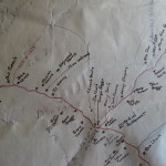
- Community Map of Pine Mountain valley – partial view of larger map showing Isaac’s Run (lower) and Little Laurel (upper), connected by Steel Trap Branch trail. [P1050593.jpg]
-
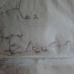
- Community Map of Pine Mountain valley – partial view of larger map showing Isaac’s Run toward Steel Trap Branch and Line Fork Settlement. [P1050592.jpg]
-
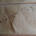
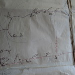
- Community Map of Pine Mountain valley – partial view of larger map. [P1050591.jpg]
-
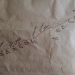
- Community Map of Pine Mountain valley – partial view of larger map. [P1050590.jpg]
-
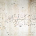
- Shell Farm, Field Plans. 1948, 1949. [320 A] Map by William Hayes. [MSR5865_1.jpg]
See Also:
FARM Shell Farm Field Plan 1948
LAND USE MAP Community Residents 1934 -1942 (By Birdena Bishop)
Return To:
LAND USE MAPS Guide