Pine Mountain Settlement School
Series 12: LAND USE
Series 18 : PUBLICATIONS RELATED
Mining
Clover Fork Case Study
Harlan County
1970s

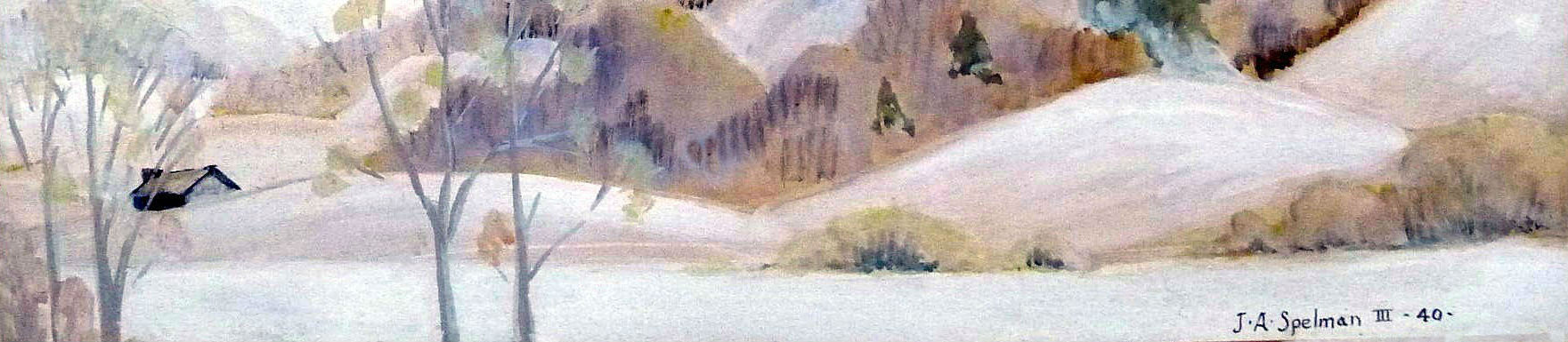
Early flooding at Pine Mountain Settlement School.
TAGS: Land Use, mining, Clover Fork, surface mining, Harlan County, Kentucky, environmental education, flood control, flooding, water resources, Strip-Mining, Harlan County 1977 Flood, Willie R Curtis, Jerry Hardt, soil erosion, sedimentation, coal mine drainage, health hazards, watersheds, Department of Natural Resources and Environmental Protection, steep-slope mining, flood reports
LAND USE COAL MINING – CLOVER FORK a Case Study
The Clover Fork Surface Mining case study was an early attempt to establish guidelines for the growing industry of surface mining in Harlan County and to mitigate the growing danger to the water resources of the County. The study is available in transcription only and without the images that once accompanied the report.
CLOVER FORK – A Case Study [Transcription only]
See also: Clover Fork Coal Co. v. Washington, 247 Ky. 848 | Casetext Search + Citator
CLOVER FORK
Abstract Clover Fork is one of three major tributaries that converge at Harlan, Kentucky to create the Northern Cumberland River. The terrain of the Clover Fork watershed is mountainous with steep ‘slopes and soils that are mostly a shallow sandy loam. (ASPI, Harlan County Flood Report). The topography and ecosystems are in a delicate balance in this region and the major surface disturbance caused by surface mining has tipped this balance to the point that the further continuation of surface mining in this watershed should be seriously considered.
Introduction; Clover Fork Region, Topography The Harlan County Watershed covers 374 square miles, and 202 square miles are drained by the Clover Fork. (Ky. Water Resource Dept., 1979). Harlan County in general has a rough, mountainous topography; steep hills and narrow valleys predominate. Very little land (less than 2%) is considered level land and only 28,000 acres (9.3%) have a slope of less than 20%. A survey by the Soil Conservation Service shows 221,000 acres on 74% of the county to have a slope of 50% or better. This steepest area is part of the Black, Little Black, and Pine Mountain Ranges that cover a sizeable portion of the county. Most of the ridgetops are narrow, generally very stoney, and composed of sandstone, siltstone, and shale to a lesser extent.
The mountains are deeply dissected by the many streams flowing into the Cumberland River and its tributaries. Head waters of Clover Fork are contained in Harlan County (Hardt, 1978).
Soil The Dekalb–Muskingum-Berks soil association predominates in Harlan County, accounting for 89.1% of all the soils in the county.
* [See also: Childress, Daniel (1992): Soil Survey of Bell and Harlan Counties, Kentucky: Volume 57. Daniel Childress Jan 1992 · Soil Conservation Service]
Surface disturbance occurs mainly in this group [of soils]. This association covers the steep hillsides and many of the narrow ridgetops. Little of this association
-[INSERT: 7 major watersheds of Harlan County The seven major watersheds of Harlan County.]
MAP Showing the size of the seven major watersheds of Harlan County, in acres. [Map not shown.]
| WATERSHED | SIZE |
| Clover Fork | 66,805 |
| Martins Fork | 74,870 |
| Poor Fork | 63,615 |
| Cumberland River | 36,396 |
| Straight Creek | 10,400 |
| Puckett Creek | 16,120 |
| Kentucky River | 31,955 |
| TOTAL | 300,160 |
(about 60% of the 3,500 acres).
The extremely rocky land of the Rockland-Dekalb association occupies 9,180 acres of very steep slopes and narrow ridgetops. Most of it consists of rock outcrops and boulders interspersed with very stoney, shallow soils formed chiefly from sandstone and shale, with some limestone in the Pine Mountain Range. Low-quality timber covers much of the soil, and erosion is again a problem where the slopes are steep. (Hardt, 1978).
THE PROBLEM
‘Introduction: Land disturbance in the Clover Fork watershed has increased erosion on the slopes along the fork and sediment build-up in the fork ·itself has contributed to the flooding potential. This is in an area where slope steepness and relatively low water retention and infiltration capacity have themselves formed a natural tendency for flooding.
Sources of Sediment Pollution Land-disturbing activities associated with mining, construction, agriculture, an logging are the major sources of sediment pollution.
Agriculture and Construction Agriculture is all but absent in Harlan County (Hardt, i978). There has been a significant reduction in farmland and cropland in eastern Kentucky since 1940, especially in Bell, Harlan, and Pike counties. Cropland harvested in 1974 constituted 1.2 percent of the area of these three counties (Floodsot, April 1977). Agricultural land disturbance is not a significant contributing factor in the sediment problem in this region.
COUNTIES LAND IN FARMS CROPLAND HARVESTED
1944 1974 1940 1974
Bell, Harlan, and Pike 418,294 36,046 67,739 2,844
(Floods of April 1977)
Construction is potentially a major sediment pollution contributor but less than 50 acres a year are disturbed in Harlan County and most are quickly covered with housing or pavement.
Logging About 550 acres are disturbed annually in logging operations in Harlan County and are subject to erosion. Poor construction of haul roads and subsequent erosion of these roads is a major contributor to Clover Fork sediment build-up. (Hardt, 1978).
Surface Mining Approximately 15,000 acres have been permitted for surface mining in Harlan County through June 1978. Ov r two -thirds of this total have been since 1970. Clover Fork has had over 2,100 acres (3.3% of the total) permitted in the same time period.
The acreage permitted is not representative of the acres actually disturbed or destroyed. Permitted acreage includes the bench width times length, plus the access roads, and in recent years hollow fills and land used for silt structures. (Hardt, 1978).
Acres permitted for surface mining on Clover Fork from 1970 to June 1978.
| Watershed | Size | Operation | Road | Total Permitted | % of Watershed |
| Clover Fork | 66,805 | 2,015 | 215 | 2,230 | 3.3 % |
Acres permitted, effectively destroyed, and disturbed by surface mining on Clover Fork, 1970 through June 1978.
| Watershed | Permitted | Effectively Destroyed | Disturbed | Total | % of Watershed |
| Clover Fork | 2,230 | 1,675 | 4,800 | 8,705 | 13.0% |
(Reference, ASPI Harlan Co. Flood Report)
Representative Rates of Erosion (Sediment Pollution) from Land uses.
| Land Use | Metric Tons Per km per year | Tons per mi2 per year |
Relative to Forest =1 |
| Forest | 8.5 | 24 | 1 |
| Grassland | 85.0 | 240 | 10 |
| Abandoned Surface Mines | 850.0 | 2,400 | 100 |
| Cropland | 1,700.0 | 4,800 | 200 |
| Harvested Forests | 4,250.0 | 12,000 | 500 |
| Active Surface Mines | 17,000.0 | 48,000 | 2,000 |
| Construction | 17,000.0 | 48,000 | 2,000 |
From the general descriptions of potential contributors to sediment pollution in this region, it appears that surface mining is the most outstanding contributor by shear magnitude alone. That is, more surface area is being disturbed by surface mining than by the sum of all other potential contributors.
THE NET EFFECT OF SURFACE DISTURBANCE
Basically, surface disturbances in terrain such as Clover Fork result in increased surface runoff, decreased net times to peak flow, and increased peak flow discharges. (Kufs, 1978). Since mining is the major cause of surface disturbance in the Clover Fork Watershed, this section will concentrate on how this happens.
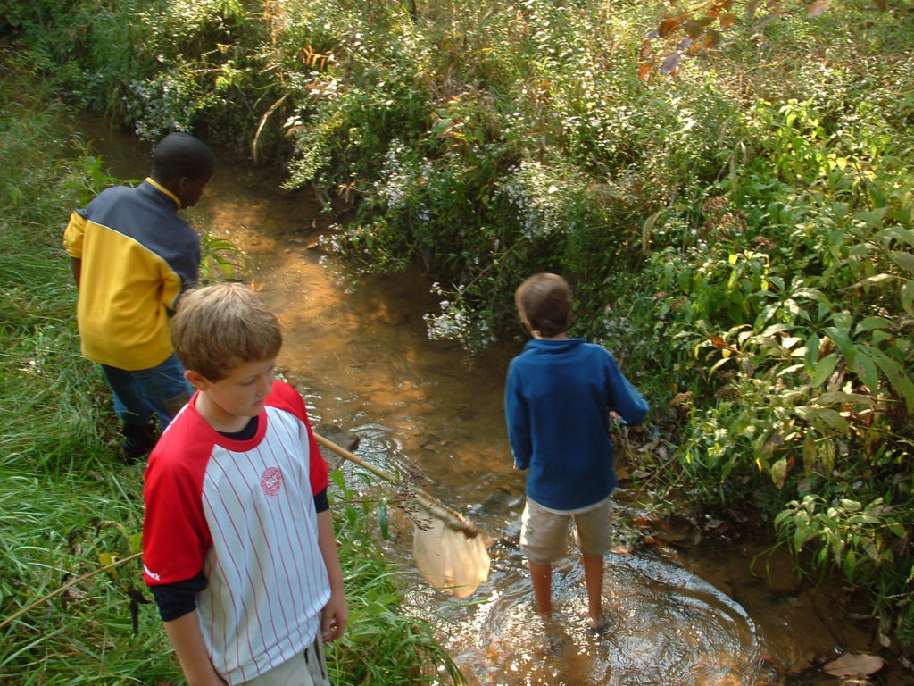
Stream ecology class. Environmental education class – St. Francis School
RAINFALL-RUNOFF FACTORS
Great variations may occur in the amount of rain that falls and what ends up in an acre waterway. Topographic, geologic, and hydrologic factors all play a part to some degree, and in given situations may significantly affect runoff totals and subsequent flood levels.
Interception After a period of dry weather, much of an initial rainfall will be intercepted before it hits the ground and temporarily stored on the vegetal cover. The denser the vegetal cover, the greater the amount of interception. Interception storage capacity is normally satisfied early in any storm. In large storms, the total amount of interception will have little effect on the overall runoff amount. Estimates of its capacity in well-developed forest areas average about 0.10 inches per storm. Intercepted precipitation is usually returned to·the atmosphere by evaporation.
Infiltration and Porosity Infiltration refers to the passage of water through the soil surface into the soil, and porosity is how much water the soil can hold per foot of depth. Quite obviously, the type of soil predominant in an area will have a great effect on these factors, as will the initial moisture content. Infiltration rates tend to be the highest ton soils per sand, gravel, and peat and the lowest ton clay soils. However, sandy soils sometimes tend to have lower capacities than clay soils. The total storage capacity available for a given soil is determined by the depth of the soil.
The infiltration rate is at most a fraction of an inch per hour. In heavy rain, neither the infiltration rate nor the porosity in themselves are considered significant factors. Existing soil moisture may eliminate or reduce these processes. In a storm of longer duration, infiltration may have more of an effect. Obviously, those soils with high infiltration and high porosity will contribute to the reduction of flood levels as they absorb and retain more rainfall than other soil types.
Depression Storage Numerous depressions may cover any surface area. When rainfall intensity exceeds the infiltration rate, these depressions begin to fill, generating puddles, pools, or even filling small pond areas. Measurement of depression storage is difficult and impractical and is usually included with an interception and treated as initial runoff loss. Since some of the depre_ssions can be deep, this storage continues to be a factor throughout the storm. However, since the drainage area of such depressions is often very limited, the overall effect on runoff may be inconsequential.
Surface Storage Surface storage is distinguished from depression storage and refers to the runoff collected by permanent bodies of water such as lakes, ponds, and reservm.::ires. This eater is then released through evaporation, ground-water seepage, or overflow. The total effect such storage has on runoff is determined by storage capacity and the drainage area in proportion,·to the watershed size.
Soil The soils of Harlan County are primarily of the sandy and silt loam variety allowing for a high infiltration rate. However, the soils are generally shallow to moderate deep limiting storage capacity. When the soil is disturbed, the more clayey and rocky subsoils will absorb and hold even less rainfall, and severe erosion is likely to occur
Vegetation The amount of vegetal cover is one of the most important considerations in determining both the rate and amount of runoff vegetation will intercept the first bit of rainfall before it reaches the ground reducing the water available for runoff. Water that doc rah the ground may again be intercepted by surface vegetation as in fl ws a ross the ground. Porosity is increased by the vegetal cover in two ways. First, the root system loosens the soil allowing more infiltration and storage capacity. Second, as the vegetation dies and decays, it leaves a cover of organic matter that also absorbs and holds water.
Vegetation inhibits flooding by reducing the amount of erosion, especially in the form of fullies since water collected by gullies would reach the main stream at a higher rate of flow than water flowing over land. Sediment may be filtered from runoff as it flows through strips of vegetation, lessening the flood damage resulting from mud deposits and reducing the rate that the streams are filling up with sediment.
Hand use is going to have a direct effect on the amount of vegetal cover. In Harlan County, where the soil is generally low in natural fertility, the slopes are steep, and·severe erosion is a potential hazard, the lack of a tali (90%) veg taL cover may lead to severe erosion problems increasing ·runoff rates and amounts and contributing to increased flood levels.
Slope Runoff from a steep watershed will be faster than runoff from a flat one. The quicker the water flows, the less opportunity there is for the water to infiltrate the soil.
In summary, there·are interception, infiltration porosity depression storage, and surface storage. vegetation, soils, and slope action to prevent precipitation from washing a hillside away. These categories help describe a system that functions if it is maintained properly. Surface disturbance acts to disrupt this system, it removes this protective coat, laying bare soils that will just wash away. Clogging stream beds, filling them up, and when this happens, precipitation has no stream to carry it away, so you have flood.
THE ROLE OF SURFACE MINING IN FLOODING, WITH PARTICULAR ATTENTION TO ITS AFFECT IN THE 1977 FLOODS.
Increased runoff rates and amounts are the immediate effects land disturbance has on rainfall surface mining destroys all forms of vegetation both on the area mind and used for hall roads and on the outslope or spoil or overburden is dumped this process immediately eliminates the interception that would take place during the initial part of the storm allowing about 0.10 more inches of rain to reach the ground the removal of a ground cover of grass or leaves takes away another source that would intercept and hold or at least **** the run off decaying vegetation and their root system of living plants helps to loosen the soil furthering the infiltration process and porosity vegetation held the precipitation its leaves and roots gather and release it through evaporation or transpiration rather than as runoff.
The removal of vegetation means more water is actually striking the ground there is less material and soil potential for absorbing the rainfall and the runoff rate is increased which further lessens the infiltration potential of the bare soil. the Boy Bear soil is much more susceptible to erosion due to the exposure of the soil to weathering elements and the lack of a root system helping to hold the soil in place.
Run off rates are increased as erosion takes place sheet erosion predominates in the initial stages of land disturbance but soon sills and galleys form in the highly erosive bare soil and grow deeper with time the run offs that forms the gullies takes the path of least resistance generally straight down the hillside into a stream or tributary a dense network of seals will often form to feed into deep one deep gully the network collects the runoff in channels at much faster to a central point parentheses the galley parentheses then would occur if vegetation were present the run-off will travel faster through the galley than it would as Overland flow
Surface mining techniques remove the natural systems that serve to limit runoff that the existing water carrying systems can carry under normal conditions referring to the opening paragraph in this section surface runoff is increased by surface mining because the natural barriers to run off are removed to obtain the underlying coal and since these natural barriers to run off are removed greater amounts of water will actually do exactly that run off additionally because the soil surfaces bare of this run off Will carry higher sediment load a load deposited at some point downstream this deposition occurs where the stream velocity slows and can no longer transport the sediment this new deposited sediment helps fill up the stream bed decreasing its size and water carrying capacity of the stream leading to a higher potential.
Clover Fork in surface disturbance and overview of studies making direct reference to Clover Fork
The floods of April 1977 Plate 4 slide debris at the mouth of small branch off Clover Fork Harlan County page 26 this is a photograph depicting a rock and soil slide in the Clover Fort Watershed plate six rock bed load at mouth of branch into which debris shone in plate 4 flowed clover Fork in foreground this photograph depicts gravel stone and coal collected in Clover Fork
Plate 8 large rock and stream bed of Clover Fork this photograph depicts a muddy stream with large stones in the stream bed implying that surface mining is the cause of the muddiness and stones.
Plate 9 sediment in bottom of channel of Clover Fork Harlan County another photograph showing silt and gravel sediment in Clover Fork.
Plate 10. Heavy sediment deposited in 1 side of channel of Clover Fork, Harlan County,” narrows the channel.” This photograph depicts a sediment bar consisting of large cobbles and stones extending far into the channel implying surface mining as the source.
Plates, including 4, 5, and 6 show erosion and spoil slides on a small hollow. Plate 7 shows small silt beds in a fairly large stream bed with coal and shale particles identified. Much larger rocks and sediment bars are also shown. The type and newness of the rocks indicate that their dislodgement resulted from mining.
From Plate 8 and 9, it is evident that the bars of larger materials such as rock and gravel both fill and narrow the channels some of this is natural nevertheless To the extent that mining adds so much sediment it tends to increase flooding.
The effect of surface mining on flooding is greatest on smaller tributaries. Plate 10 shows a hollow, the channel of which was filled and overflowed with rocks from a slide below a mine. Farther downstream water generally moves more slowly and heavy bed load is dropped. (11 The Floods of April, 1977)
Harlan County Flood Report
“Timbering creates the greatest problem around these three land uses” Agriculture, building construction and timbering”; About five hundred and fifty acres are disturbed annually in the county by logging practices and subject to erosion poor construction of hall roads has resulted in several slides occurring in the Clover Fork watershed during the heavy flood rains of 1977.”
“Areas in the greatest danger ,,, from the direct effects of sediment build up ” …in the Clover Fork areas of Childs Creek. (Hardt 1978)
The previous references to the Clover Fork watershed and existing incidents of surface were included to Lend credence to the statement that sediment pollution is creating a serious flooding potential in the Clover Fork region. However, since there appear to be no studies of the Clover Fork watershed and the effects surface mining has had, the next section will discuss a study made in Breathitt County in conjunction with the U.S.G.S that appears to be a region similar to Clover Fork and analogies will be made.
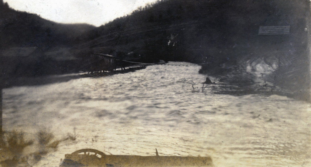
“In the Days of High Tides. – Big Laurel.” Greasy Creek at flood stage.JUnction of Laurel and Greasy Creeks. nesb_063_mod.jpg
THE BREATHIT COUNTY STUDY
beginning in 1967, Willie R. Curtis, Hydrologist for the US Forest Service, began a study to evaluate the effects of surface mining on the water resources of small Appalachian watersheds. Even though the observations represent case-history studies of individual watersheds, basic knowledge gained should be applicable to much of the coal-producing mountain land throughout Appalachia. (Curtis 1, 1977) With basic tenant in mind, Mr. Curtis conducted his study oF essentially six watersheds in Breathit County.
| WATERSHED (Name)) | AREA (Acres) | APPROX. AREA DISTURBED (%) |
| A | 380 | 47 |
| B | 172 | 60 |
| C | 283 | 16 |
| Bear Branch | ||
| Jenny | 287 | 0 |
| Miller | 190 | 30 |
| Mullins | 327 | 2 |
With the Clover Fork water having approximately 13% disturbance in 1978, particular attention will be made in Leatherwood Creek C Watershed of similar size.
Results
“Surface mining for coal has altered the natural processes and affected the water resources in the study watersheds. (Curtis1971) Significant changes were observed in erosion and sediment yield of the mind watersheds. (Curtis 1971). Changes in chemical quality have also been reported (Curtis 1971). “But perhaps the most important change in stream flow after surface mining was the increase in peak discharge.” Continuing, “… in a number of pained comparisons of peak flows were made to cover conditions before and after mining …” “Runoff peaks in unmined, “Jenny, averaged 6.9 C.S.M.P. (cubic feet per square mile at peak). “Leatherwood C ” (16 %t disturbed) had storm peaks averaging 15 C. S. M. P.” This is more than a twofold increase in peak flow runoff. Clover Fork in 1978, again, had 13 % disturbance. Extrapolating, Clover Fork is experiencing at least a two-fold increase in peak runoff due to surface disturbance.
Discussion
……” there can be little doubt that storm peaks have increased after surface mining. The flood potential has increased. And, if we also add the reduced channel carrying capacity due to silting, we would see a further increase in the flood potential.”
Continuing: “A number of factors come into play on a strip-mined watershed that affects peak flows, some to a limited degree perhaps and some to a larger degree. The forest canopy is removed Thus the amount of interception decreases the decrease in interception will result in an increase in water available for quick flow and peak discharge though the increment may not be very large with the removal of the forest canopy there is a decrease in transpiration however this is offset partly by increased surface evaporation.
After the initial wetting of the spoil material, further moisture retention is nil. The spoil may retain at or near field capacity for a long time because little moisture is removed through evapotranspiration This means that very little of the initial storm precipitation goes into the subsurface storage. Thus, the quick flow and peak flows may be larger. Surface sealing is commonplace on mine spoils where the overburden is mainly shale conditions conducive to high notes of overland flow are thus quite common.
The flood potential after surface mining in Appalachia becomes more and more important with the increase in percent of land disturbed. Peaks from shale areas will flatten out as the flows join streams from other drainages however if a number of small drainages in a watershed are mined the flood potential in the watershed may be greatly increased. ( Curtis 1972)
And to draw an analogy to conclude this section in the Breathitt County study surface disturbance is shown to have increased runoff in flooding potential in going from an undisturbed to a mined condition. Since 1970 Clover Fork has experienced a similar transition. This change in Clover Fork has apparently had a similar effect in runoff and flooding potential.
Solution
Again from Curtis, “A vegetative cover quickly established should give some control over erosion. But what about storm runoff peaks? And how do we get the quick cover necessary?
Terraces and other water retarding can be used on many areas. But if water is caused to soak into the spoil what does this do to the stability of spoiled banks?
Surface mining is becoming a widespread practice when used on steep mountain areas it causes watershed problems. We must find ways to manage surface mining not only to reduce on-site damages but also to minimize harmful effects on the water resource. Mining methods and reclamation techniques must be developed so that land managers can protect watershed Cvalues hwile at the same time the coal, a vital source of energy, can be utilized. (Curtis, 1, 1972)
These offerings from Curtis do indeed lend incentives and belief that reclamation of surface mined land can be successful in the Appalachian region in particular the Clover Fork area. The Floods of April study by the D.N.R.E.P. further supports Curtis’s study by saying, “The vegetative growth on reclaimed areas of Miller and Mullins branches in April 1977 was well established. According to Curtis, it provided a superior canopy and much more soil surface porosity than natural forests on Jenny Branch.” Continuing, this would indicate that although runoff and erosion increases due to active surface mining reclamation and weathering of these areas result in better hydrologic conditions than existed prior to mining.” (Floods of April 1977) This is true if adequate reclamation is [to be] possible.
Argument
The federal surface mining law requires the stripped mountain to be put back into the appropriate contour according to the authors of the Harlan County Flood Report, ASPI Research Series , “The basic nature of the steep slopes of eastern Kentucky suggest resistance too and in some cases defiance of satisfactory containment and reclamation as evidenced by slides, eroding and sliding mountainsides, and disappearing silt-laden streams,” This may not be possible the authors of the Harlan County Flood Report think that”… the heavy annual rainfall and the steep original slope of Harlan County and eastern Kentucky, make reclamation technologically impossible as well. Complete revegetation is a virtually unachievable feat in Harlan County”.
Mr Curtis, again, “with proper reclamation erosion and flooding can be controlled.”( Curtis 1, 1972). The authors of the flood report continue to say that this is technologically impossible. (Hardt 1978 )
The federal surface mining law has provisions for designating areas unsuitable for surface mining. Section 522 (a) (3) (0) calls for such designation if mining operations will affect natural hazard lands in which such cooperation in which such operations could substantially endanger life and property, such lands to include areas subject to frequent flooding and areas of unstable geology. The law calls for a ban on surface mining in an area if reclamation is not technically or economically feasible also the KRS 350. 085 allows D. N. R. E. P. not to issue permits if it finds that such an operation constitutes a hazard.
The evidence finds to lean toward the direction that it is up to the regulatory body that acts to enforce existing laws as to whether surface mining in the Clover Fork region is to be continued or not. The existing laws state that if a hazard exists mining is to be stopped and no further permits issued. The studies say that surface mining increases flood potential in an area already prone to flood due to its physical nature. (Hardt 1978).
GALLERY – COAL MINING AT CLOVER FORK, HARLAN CO., the coal a vital resource KENTUCKY [ Images not available
BIBLIOGRAPHY
Hardt, Jerry. Harlan County Flood Report, Appalachian Science in the Public Interest, Corbin, Kentucky, 1978.
“Water Resources Data for Kentucky.” U.S.G>S> Survey Water-data Report. Ky. -79-1. Water- Year 1979. Commonwealth of Kentucky, U. of Ky, K>G.S. 1979
Kufs, Charles. Evaluation for the Effects of Surface Mining on Coover For and Cranks Creek Watershed in Harlan County, Kentucky, 1978.
Curtis, Willie R. (2) “Chemical changes in stream flow following surface mining in eastern Kentucky.” Coal Mine Drainage Research Symposium on Watersheds in Transition, American Water Resources Association and Colorado State University, No. 14, 1972.
Curtis, Willie R. (2) “Chemical change in stream flow following surface mining in eastern Kentucky.” Coal Mine Drainage Research Symposium Proceedings. 4:26-27. Pittsburg, Pa. 1977.
Curtis, Willie R. “Stri -Mining, Erosion, and Sedimentation.” Transaction of the American Society of Agricultural Engineering. 14:434, 435-436, 1971.
“The Floods of April.” Department of Nautral Resources and Environmental Protection, staff study. pp. 123-133, November 1977.
SEE ALSO
LAND USE Water Protection Plan 1997-98
031 PHOTOGRAPHY ENVIRONMENTAL EDUCATION Water
PHOTOGRAPHS VIII DISASTERS Floods, Fires, Railroads
LAND USE DOLLAR BRANCH Correspondence
LAND USE Lands Unsuitable for Mining Petition